Introduction
 |
| Abra Natural Dye's |
The palette of hues hails from an array of elements found in nature—plants, tree bark, fruits. Witness the mesmerizing deep blue of the ceremonial kinnamayan textile, a legacy of the northern Abra Itneg, painted by the indigenous indigo plant called malatayun. This dye craft, summoning vivid shades from blue to violet, echoes across Southeast Asia and parts of Europe, revealing shared artistry.
 |
| Stunning Apao Rolling Hills in Tineg, Abra |
Ancient Past
Abra, nestled in the northern expanse of the Philippines, bears a rich historical tapestry that unfolds across different epochs. Before the arrival of colonial powers, Abra's terrain was traversed by the forebears of Bontocs and Ifugaos, who eventually departed to settle in the ancient Mountain Province. Yet, within this rugged expanse, thrived another indigenous group known as the Tingguians or Itnegs, establishing their own cultural presence. |
| Itneg People with their distinctive White G-String |
The Colonization by the Spaniards
The advent of the Spanish era ushered in a transformative epoch. In 1598, a Spanish garrison was erected in Bangued, aiming to shield the Christian Ilocanos from the frequent Tingguian incursions. The region, originally christened as El Abra de Vigan or “The Opening of Vigan,” witnessed pivotal moments, notably the refuge of the valiant Gabriela Silang and her insurgent band, evading from Ilocos to Abra. Gabriela continued the rebellion ignited by her husband, Diego Silang, but her valor met a tragic end when she was apprehended and executed by the Spanish in 1763.
The evolution of Abra's administrative landscape endured fluctuations. In 1818, Abra found itself delineated between Ilocos Norte and Ilocos Sur within the broader Ilocos region. However, its political geography further morphed in 1846, ascending to the status of a political-military province with Lepanto as its sub-province. This configuration persisted until the American arrival in 1899.
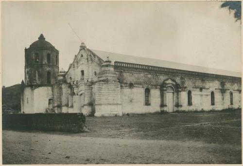 |
| Old Picture of Bangued Cathedral |
Arrival of the Americans
The American period marked a chapter of fluctuating affiliations. In 1908, the Philippine Commission annexed Abra back to Ilocos Sur in a bid to mitigate Abra's economic challenges. Yet, the pendulum swung again on March 9, 1917, as the Philippine Assembly reasserted Abra's status as a province, an incarnation that endures in the province's current political framework.
The Japanese Invasion
The shadows of World War II cast their gloom over Abra as Japanese forces occupied its territories in 1942. However, hope flickered amidst the tumult as Abra witnessed its moment of liberation during the Battle of Abra in 1945. The Philippine Commonwealth forces alongside the gallant local Cordilleran guerrillas orchestrated a triumphant stand, reclaiming Abra's sovereignty at the culmination of the harrowing Second World War.
Through the cycles of colonization, annexation, and war, Abra endured, weaving a vibrant tapestry of cultural resilience and historical fortitude. The echoes of its past continue to resonate within the fabric of its contemporary existence, a testament to the enduring spirit of a land marked by trials and triumphs.
Comments
Post a Comment